REASONS TO BUY
Huge touchscreen
Fast processing speed
Shock and water resistant
REASONS TO AVOID
Big and heavy
Expensive
Less practical as a handheld unit

 This Product
Garmin Montana 700 | |||||
|---|---|---|---|---|---|
| Awards | |||||
| Price | $600 List $521.39 at Amazon | $450 List | $550 List | $229.99 at Amazon Compare at 2 sellers | $110 List |
Overall Score  |
|||||
| Star Rating | |||||
| Bottom Line | Essentially a mounted unit redesigned to be taken out-and-about, but limited as a handheld by its large size and weight | This model is a top-of-the-line GPS unit for a wide variety of conditions | This touchscreen model offers the user-friendly interface of a smartphone, with many of the capability of higher-end units | A cost-effective unit, with significantly improved capability thanks to the addition of an altimeter and electronic compass | A solid entry-level unit for the geocaching crowd, or as an emergency backup |
| Rating Categories | Garmin Montana 700 | Garmin GPSMAP 66st | Garmin Oregon 750t | Garmin eTrex 32x | Garmin eTrex 10 |
| Reception (20%) | |||||
| Ease of Use (20%) | |||||
| Display Quality (20%) | |||||
| Speed (15%) | |||||
| Weight and Size (15%) | |||||
| Versatility (10%) | |||||
| Specs | Garmin Montana 700 | Garmin GPSMAP 66st | Garmin Oregon 750t | Garmin eTrex 32x | Garmin eTrex 10 |
| Battery Life | GPS Mode: 18 Expedition Mode: 330 |
GPS Mode: 16 hours Expedition Mode: 170 hours |
16 hours | 25 hours | 25 hours |
| Water Resistant? | Yes, IPX7 | Yes, IPX7 | Yes, IPX7 | Yes, IPX7 | Yes, IPX7 |
| No. of Waypoints | 10,000 | 10,000 | 10,000 | 2,000 | 1,000 |
| Saved Tracks / Points per Track | 250 / 20,000 | 250 / 20,000 | 250 / 20,000 | 200 / 10,000 | 100 / 10,000 |
| Preloaded Maps | US Federal Public Lands; Garmin TopoActive (regional) |
Topo 100k, US and Canada | Topo 100k, US | Garmin TopoActive; Routable (OpenStreetMap) |
Simple Basemap |
| Dimensions (in.) | 3.4 x 7.2 x 1.3 | 2.5 x 6.4 x 1.4 | 2.4 x 4.5 x 1.3 | 2.1 x 4.0 x 1.3 | 2.1 x 4.0 x 1.3 |
| Weight w/ Batteries (oz.) | 14 | 7.5 | 7.4 | 5 | 4.6 |
| Display Size (in.) | 4.25 x 2.55 | 1.5 x 2.5 | 1.5 x 2.5 | 1.4 x 1.7 | 1.4 x 1.7 |
| Display Resolution (pixels) | 480 x 800 | 240 x 400 | 241 x 400 | 240 x 320 | 128 x 160 |
| Built-in Memory | 16 GB | 16 GB | 4 GB | 8 GB | 6 MB |
| Accepts Data Cards | microSD | microSD | microSD | microSD | No |
| Touchsceen or Buttons? | Touchscreen | Buttons | Touchscreen | Buttons | Buttons |
| Electronic or Differential Compass? | Electronic | Electronic | Electronic | Electronic | Differential |
| Barometric Altimeter | Yes | Yes | Yes | Yes | No |
| Wireless Communication? | Wi-Fi, Bluetooth, ANT+ | Wi-Fi, Bluetooth, ANT+ | Wi-Fi, Bluetooth, ANT+ | ANT+ | No |
| Satellite Systems | GPS, GLONASS, Galileo | GPS, GLONASS, Galileo | GPS, GLONASS | GPS, GLONASS | GPS, GLONASS |
| Ability to Add Maps? | Yes | Yes | Yes | Yes | Yes |
| Support Satellite Imagery? | Yes | Yes | Yes | Yes | No |
| Automatic Routing | Yes | Yes | Yes | Yes | No |
| Vertical Profiling | Yes | Yes | Yes | Yes | Yes |
| Camera/Video | No | No | Yes, 8MP Camera | No | No |
| Picture Viewer | Yes | Yes | Yes | Yes | No |
| Geocaching (paperless) | Yes | Yes | Yes | Yes | Yes |
| Hunt/Fish Calendar | Yes | Yes | Yes | Yes | Yes |
| Sun and Moon Information | Yes | Yes | Yes | Yes | Yes |
| Area Calculator | Yes | Yes | Yes | Yes | Yes |
| Battery Information | Rechargeable lithium ion battery pack | 2 AA Batteries | 2 AA Batteries; Rechargeable NiMH pack (optional) | 2 AA Batteries | 2 AA Batteries |
| Online Connect Communities | Garmin Connect; Connect IQ |
Garmin Connect | Yes | No | No |
| Screen Info | WVGA transflective, dual orientation | Transflective color TFT | Transflective color TFT | Transflective, 65K color TFT | Transflective, monochrome |
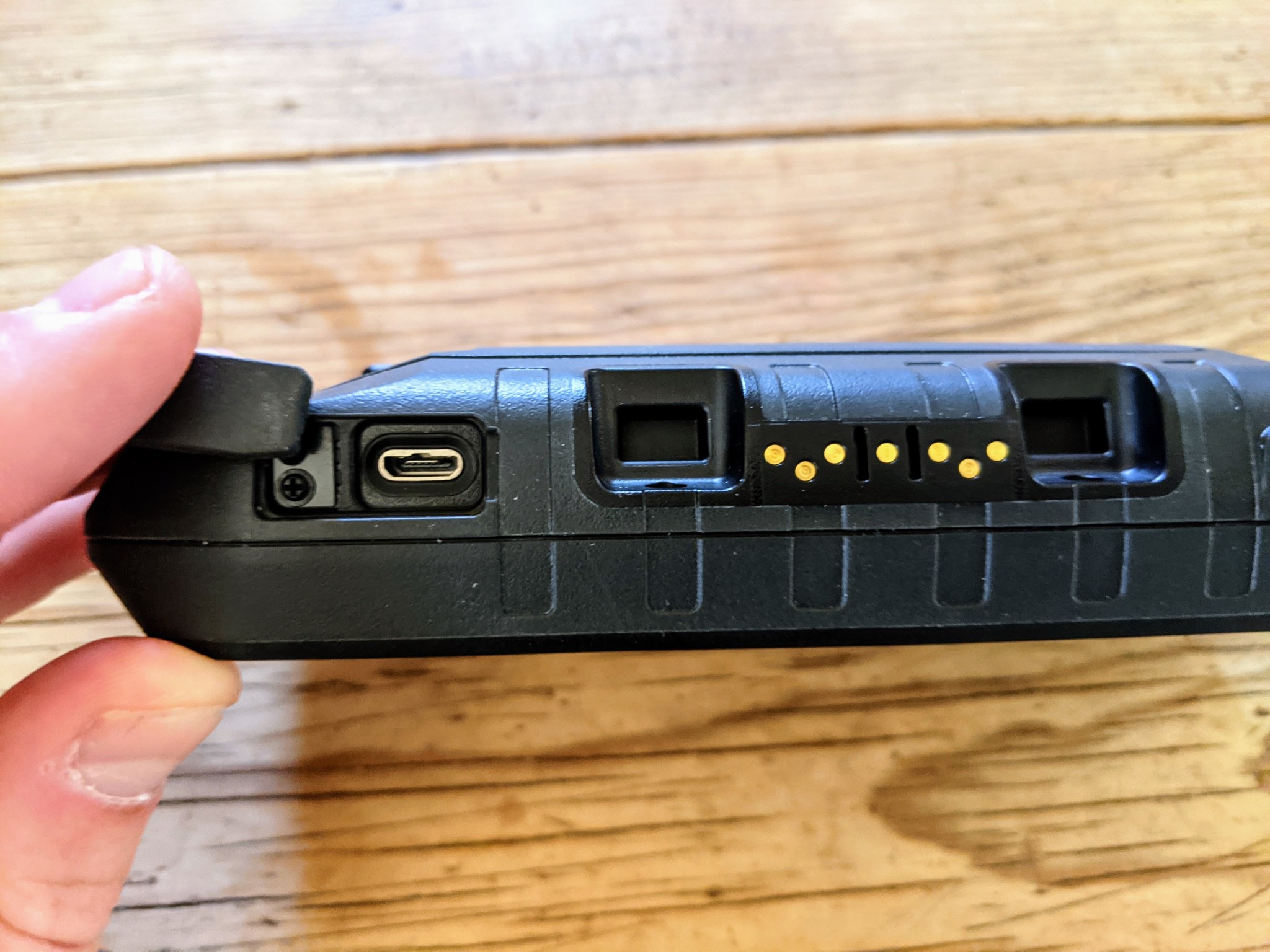
| Interface Information | High-speed micro USB; NMEA 0183 | High-speed micro USB; NMEA 0183 | High-speed micro USB; NMEA 0183 | mini USB | mini USB |
| What Comes in the Box? | -BirdsEye Satellite Imagery subscription included
|
-BirdsEye Satellite Imagery subscription included
|
-BirdsEye Satellite Imagery 1-year subscription included
|
-USB cable
|
-USB cable
|
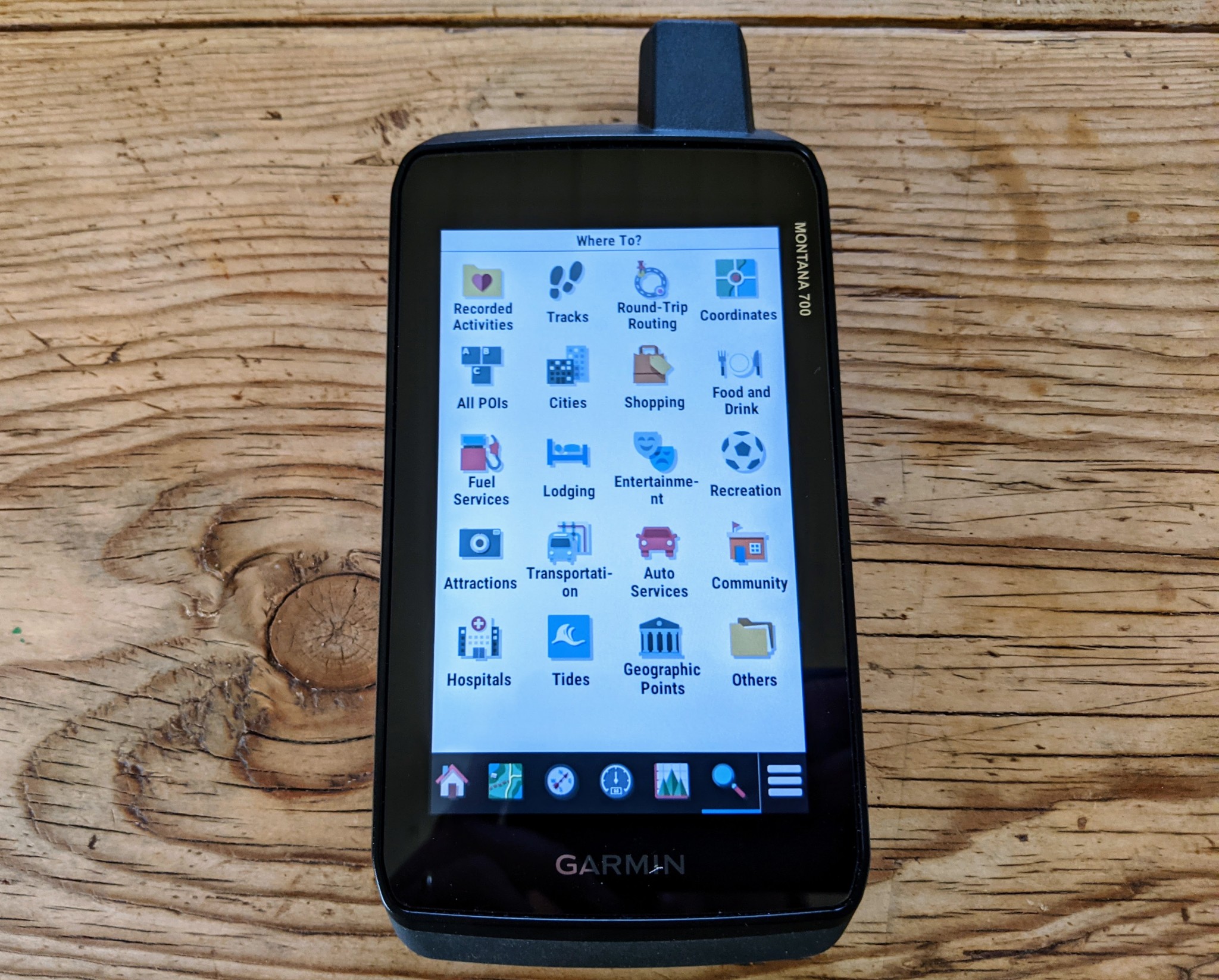
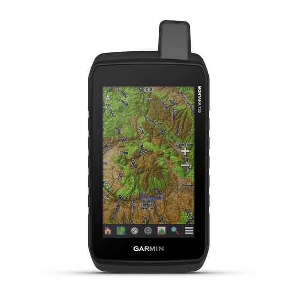
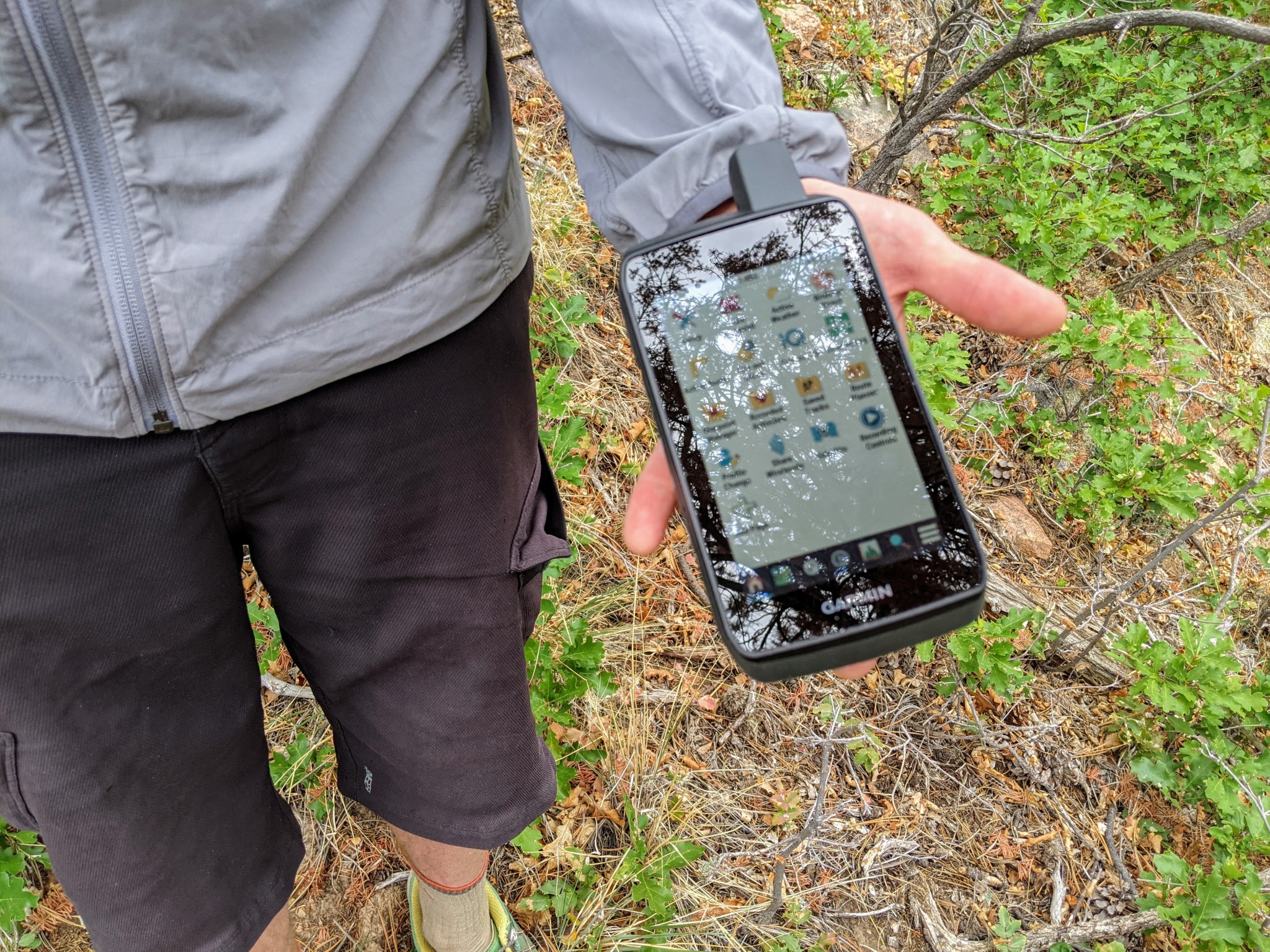
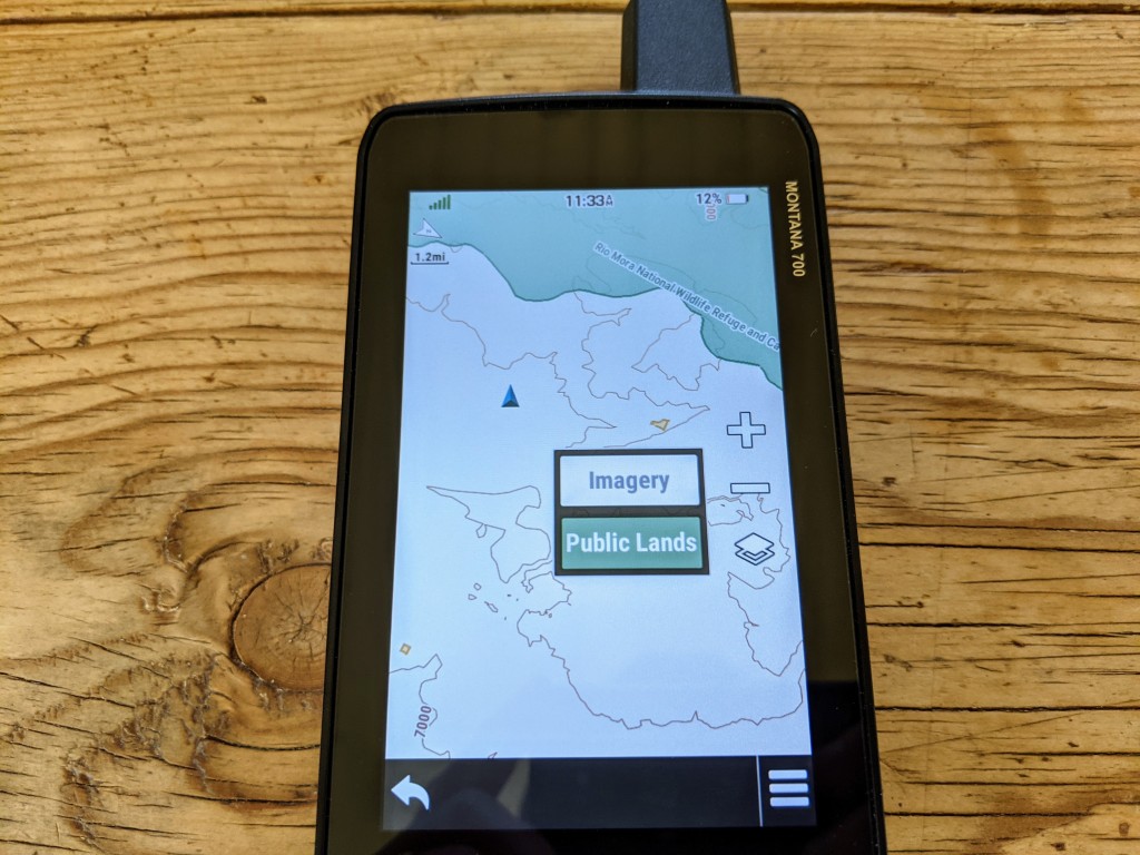
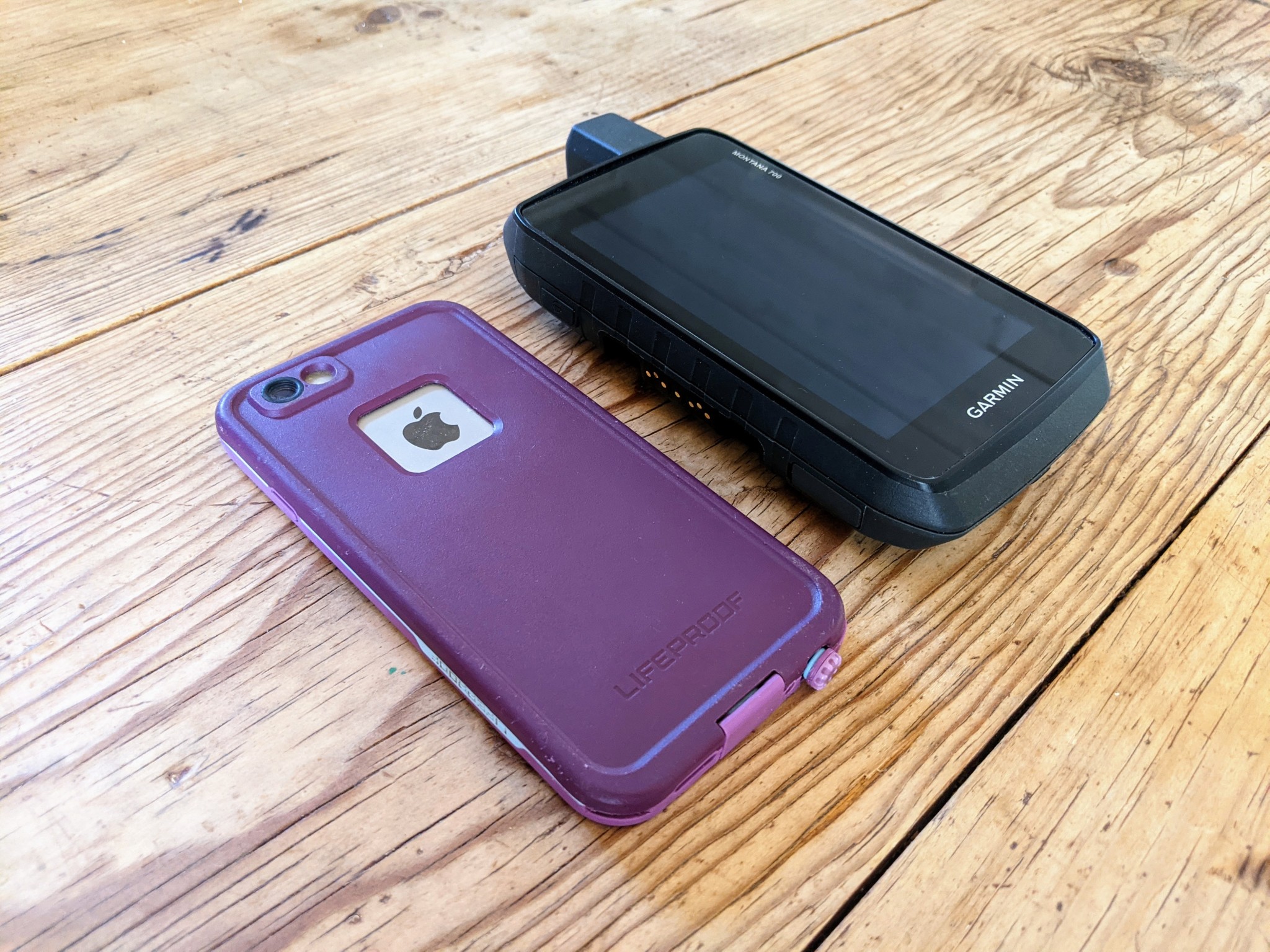
The Montana 700 is a beefy handheld — more accurately, it is like a very thick smartphone. But it features an unparalleled 480 x 800 pixel, 5-inch diagonal touchscreen — a 50% boost in size from previous Montana models. Thankfully considering its size and price, the unit meets military standards for thermal, shock, and vibration tests, including an IPX7 rating. It supports GPS, GLONASS, and Galileo satellite systems, and the 16GB of internal storage comes preloaded with US Federal Public Lands layers stacked on Garmin's TopoActive regional maps and includes an unlimited subscription to Garmin's BirdsEye Satellite Imagery. It also sports an Expedition Mode, which increases battery life up to a claimed 330 hours for extended field time.
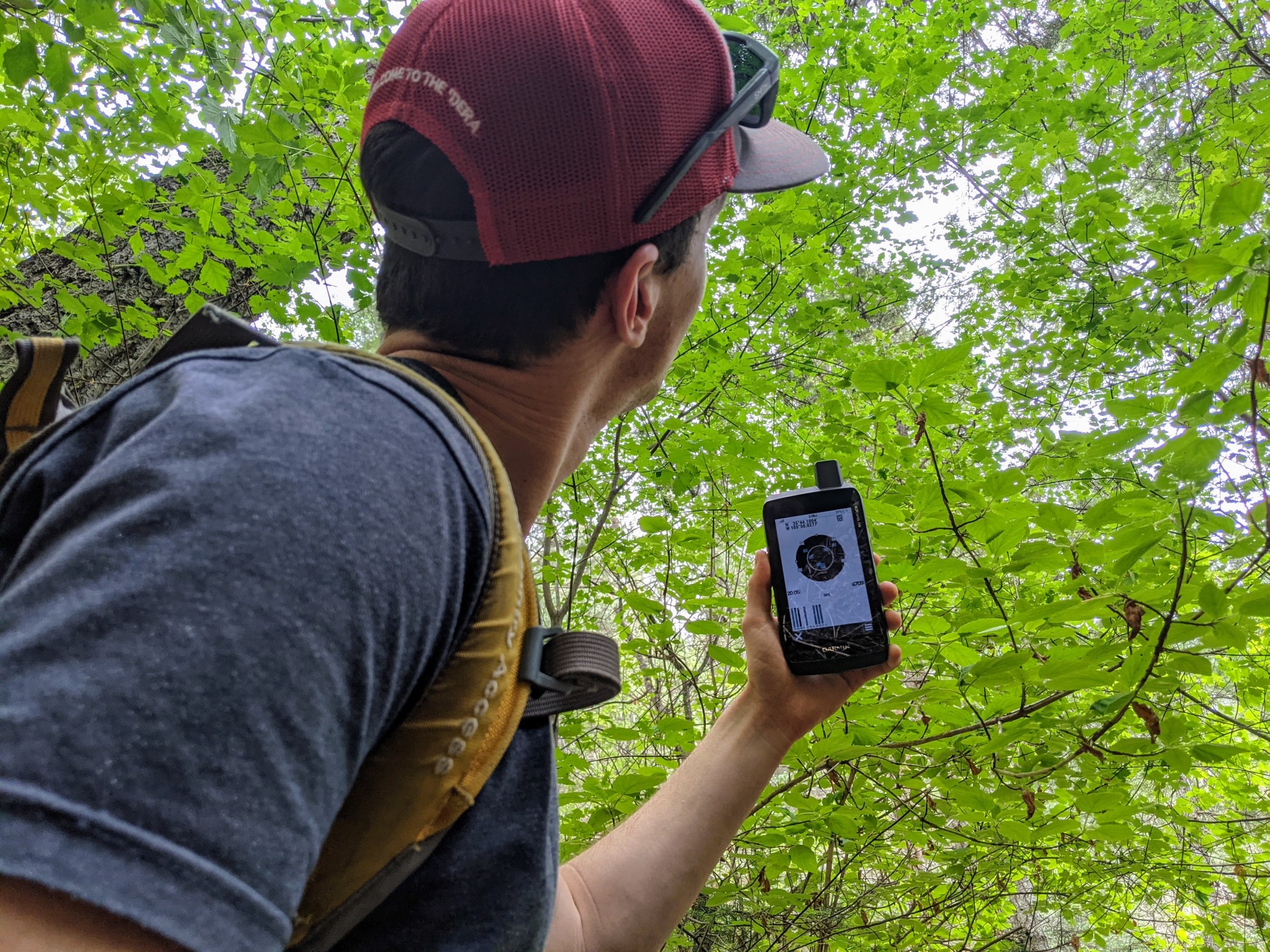
This GPS seems to have one of the best-designed antennas of any in this review — heavily forested coverage is no match for its powerful receiver, and even testing its capability inside only minorly hampers the satellite signal. This unit is one of the few that supports GPS, GLONASS, and the (relatively) new Galileo platform launched by the EU in 2016; it also has the ability to toggle WAAS/EGNOS for improved position accuracy. Interestingly enough, an average GPS accuracy of 9-feet didn't change from inside to outside — sub-10-foot (3-meter) accuracy rivals that of most publicly accessible satellite information and is much more than adequate for routable, on-road navigation or following contour lines off-road.
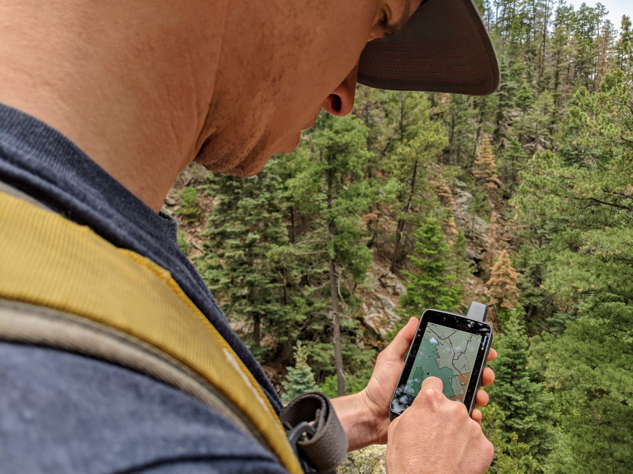
The enormous touchscreen, coupled with extensive preloaded basemaps, makes the Montana 700 easily one of the most capable GPS units in this review. The combination of interactive topographic maps with optional overlays of public land boundaries and an unlimited subscription to BirdsEye Satellite Imagery makes this unit practically a portable version of computer-based popular mapping applications like CalTopo or Gaia, which tend to be limited in their mobile capabilities. To walk through the extent of the features of this unit would take up the entirety of this article, plus some — instead, consider that the Montana 700 is fully customizable for any purpose, from planning routes on the device, to routable navigation for on- or off-road travel, to tracking hunting dogs. However, much of this capability hides behind a series of menus and customizable features, which will likely take a significant amount of time to learn how to set up to your liking.
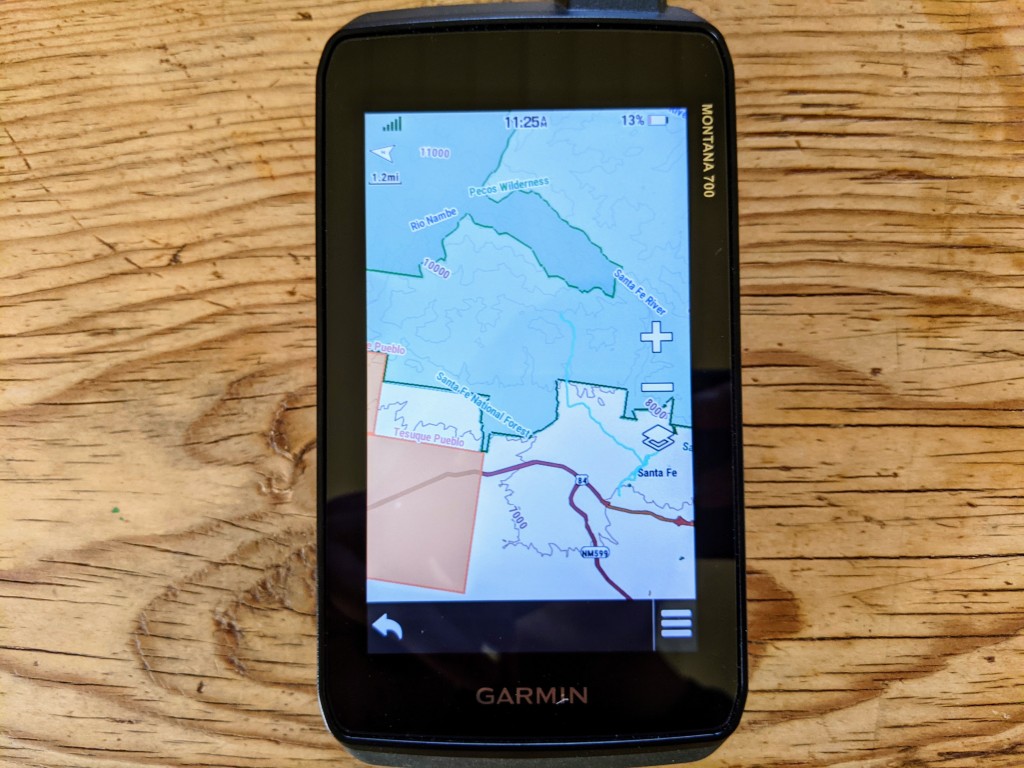
It's difficult to even compare the display quality of this unit against others in this review. Set side-by-side with much of the competition, the 480 x 800 pixel, 5-inch diagonal, WVGA screen may as well be a small computer. This unit's transflective screen stays clear, bright, and easy to read, even in sunny conditions. Unlike other options where the screen is actually too small to make much of a difference, the dual orientation of this touchscreen actually comes in handy for sharing route information with someone and particularly for routable navigation while driving. While it is technically a "handheld" unit, the size and quality of the display make the Montana 700 our top choice for mounting to a vehicle.
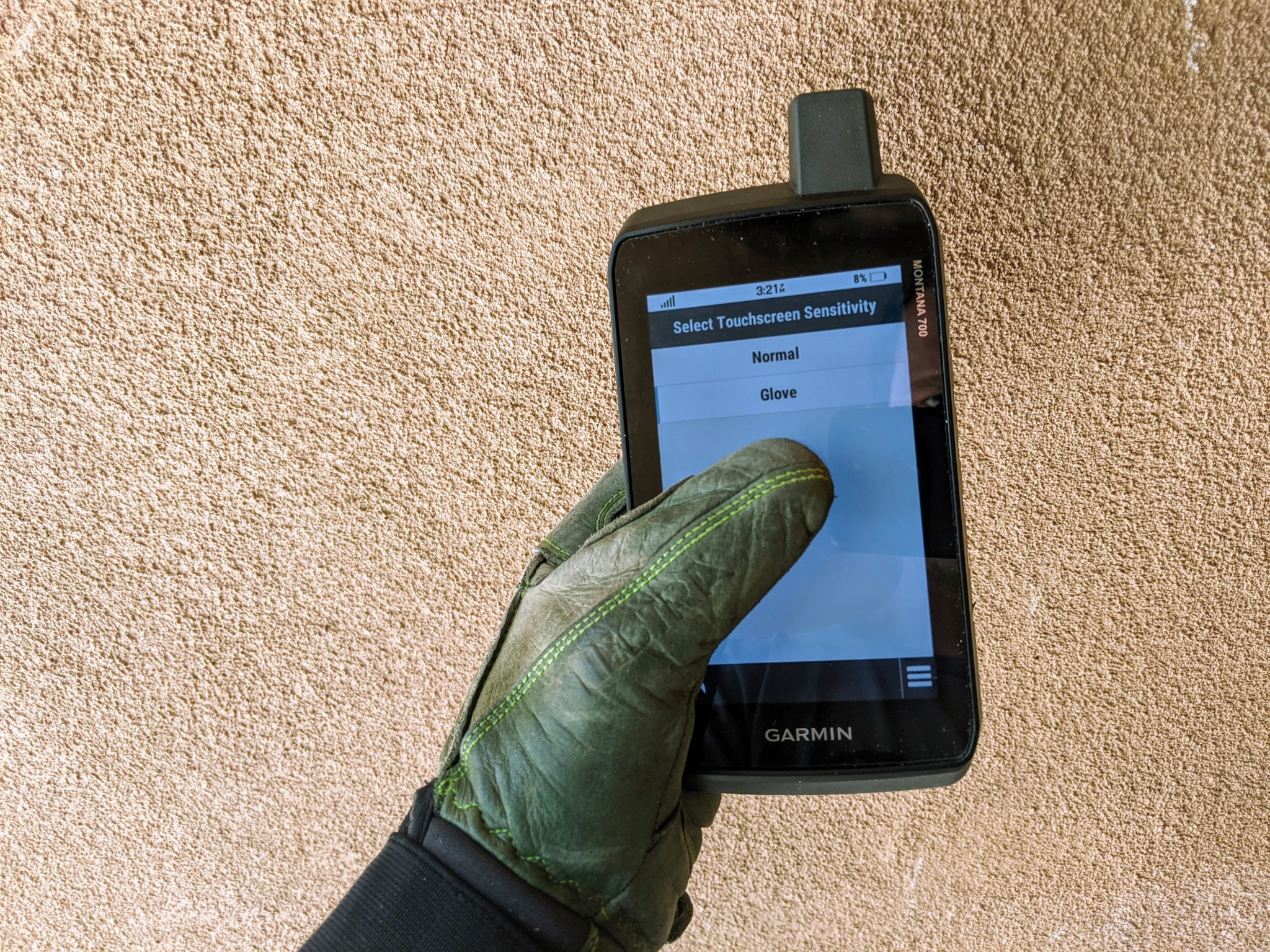
Tied to the power of its multi-sensor platform — and likely the size and power of its internal processor — the Montana 700 is one of the fastest GPS units we tested. We tested for location time and accuracy both inside (under cover of a roof) and outside, and in each setting, this was the fastest to receive and refine its satellite signal. In many instances, it would acquire its first signal — albeit at a large resolution — within less than 10 seconds and have a practical read on location in an average of 16 seconds after boot-up. Similarly, processing speed is ultra-smooth, with minimal-to-no lag time when adjusting the map, and particularly fast directional and altitude adjustments, thanks to the hyper-sensitive altitude, barometric, and compass sensors.
While the Montana 700 may excel in terms of computing power, functionality, and display quality, it all comes at a cost — which is the size and weight of the unit. Most models tend to weigh in around 5- to 7-ounces, while this beefy GPS tips the scales at 14-ounces (with its included battery pack.) In your hand, it feels like a very beefy smartphone, one that is much thicker than we're used to. Compared to other options, it is just too big to reasonably carry around, even to try to fit into a backpack. Just a few more reasons why this GPS unit is best suited to mounting on a vehicle — its portable, "handheld" functionality means that it can easily be swapped between your car, UHV, ATV, snowmobile, motorcycle, or boat.
Although the size and weight of this unit severely limit its versatility relative to its GPS capability, we are not trying to reduce it to little more than a portable version of a car-GPS. In fact, the rugged Montana 700 was designed specifically for backcountry use. In particular, it is engineered up to MIL-STD 810 testing standards for heat, shock, vibration, and an IPX7 rating for water, which means that this unit is fully waterproof up to 1-meter (~3-feet) deep. It also includes an Expedition Mode, which limits tracking capability but increases battery life up to a claimed 330 hours. The Montana 700 seems like an ideal hunting unit: it is rugged, can survive extended trips, is capable of mounting to an ATV, UHV, or snowmobile for navigating forest roads, and can reasonably be put in a pack or pocket when traveling on foot.
Considering its programmable features, the extent of the preloaded topographic maps, and its unlimited subscription to Garmin's BirdsEye Imagery, the Montana 700 is well-worth its substantial price tag. If you are looking for a compact, mobile unit for light-and-fast trips on foot, then this is not your GPS of choice. But for those who will mainly use this as a mounted unit, its advanced features and touchscreen give this GPS boundless capability.